A century ago, Punggol was a quiet kampong fishing village at the north-east tip of Singapore — wooden stilt houses on muddy creeks, family-run prawn ponds, and pig and poultry farms supplying the city. Today it's a model "eco new town" with the only waterway through the heart of an HDB estate, the Punggol LRT loop, and the Punggol Digital District rising along its edge. This guide walks you from that history to the modern waterfront, with a quiet island at the end of the path.
A century of Punggol — the short story
The name Punggol probably comes from a Malay word meaning "the place where fruits are thrown down" — a reference to the village's old role as a stop for trading boats. The history, in headlines:
- Early 1900s: a poor kampong of Malay, Chinese (Teochew and Hakka) and Indian fisher and farmer families, with no electricity or piped water until the mid-century.
- February 1942: Punggol Beach is the site of one of the most brutal Sook Ching massacres — around 300–400 Chinese civilians shot by the Japanese during the wartime occupation. A small memorial marker stands at Punggol Point today.
- 1950s–1980s: Punggol becomes Singapore's seafood country — the Punggol Point seafood restaurants are weekend institutions, and pig farms still dot the coast.
- 1980s–2000s: the kampongs and farms are progressively cleared. The last residents move out by the late 1990s.
- 2010s: HDB launches Punggol as a 21st-century waterfront town — the Punggol Waterway is built straight through the estate, Punggol Settlement is rebuilt as a waterfront F&B strip, and the LRT loop opens.
- 2020s: the Punggol Digital District rises around SIT Punggol Campus — an integrated tech campus and JTC business park.
Getting to Punggol
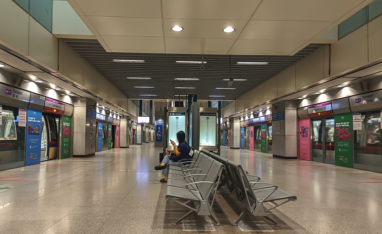
NE17 / PTC (North East Line + Punggol LRT) — the interchange. The MRT brings you from town; the LRT loops around the waterway estate.
The Punggol LRT runs as two loops (east and west) circling the estate. For Punggol Waterway Park, the closest LRT stops are Damai (PE7) on the east loop and Soo Teck (PE6). For Punggol Settlement and Coney Island, the easiest move is bus 84 from Punggol Bus Interchange (under Punggol Plaza).
Stop 1 · Punggol Waterway Park
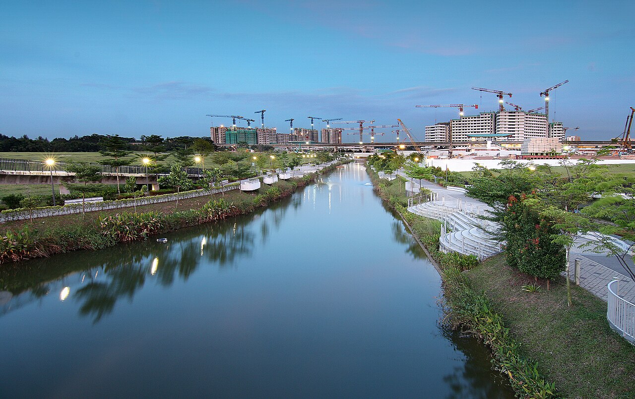
The Punggol Waterway is a 4.2km man-made canal that runs through the heart of the Punggol estate. Walk or cycle along its banks and you'll see four named pedestrian bridges: the Jewel Bridge, the Adventure Bridge, the Wave Bridge and the Kelong Bridge (a wooden boardwalk recalling old fishing kelongs). The waterway connects to Sungei Serangoon at one end and Sungei Punggol at the other — it's the spine of the new town.
Best done on a bicycle. You can rent at Punggol Settlement or via several Bicycle GPS rental schemes. Plan 1.5–2 hours end-to-end.
Stop 2 · Punggol Settlement & Punggol Point
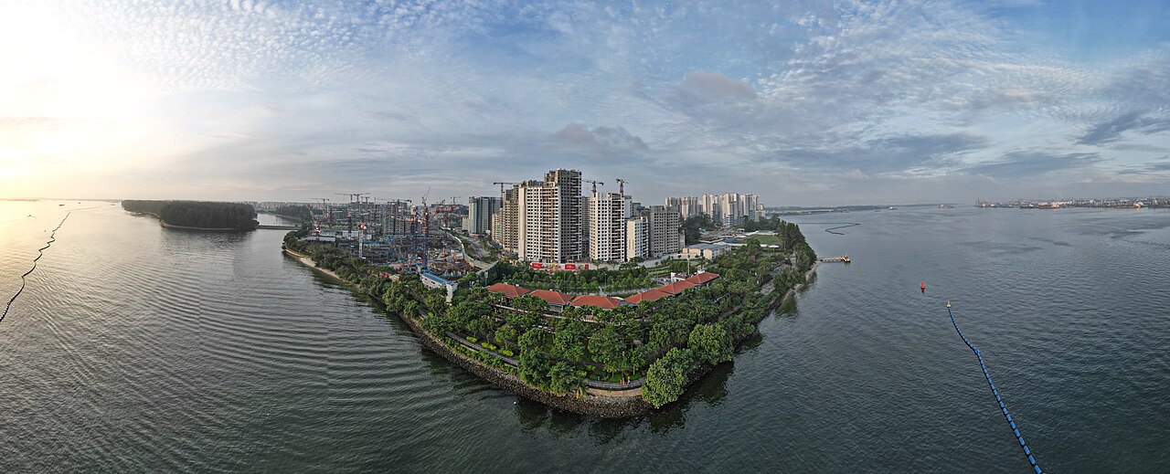
Punggol Settlement is the rebuilt waterfront F&B strip that took over from the old Punggol Point seafood restaurants. The classic Singapore seafood village tradition lives on here: chilli crab, black pepper crab, salted-egg prawn, white pepper crab and live seafood tanks at the door. There are also brunch cafés, an Indian-fusion restaurant, and a microbrewery.
Behind Punggol Settlement is the small Punggol Point Park with a viewing jetty, a small WWII Sook Ching memorial marker, and the Punggol Promenade Nature Walk — a coastal path that leads east toward Coney Island.
84 runs the short loop from the MRT to Punggol Settlement (around 10 minutes). Search "Punggol Settlement" in GoBus SG for the closest stop.
Stop 3 · Walk the Punggol Promenade Nature Walk to Coney Island
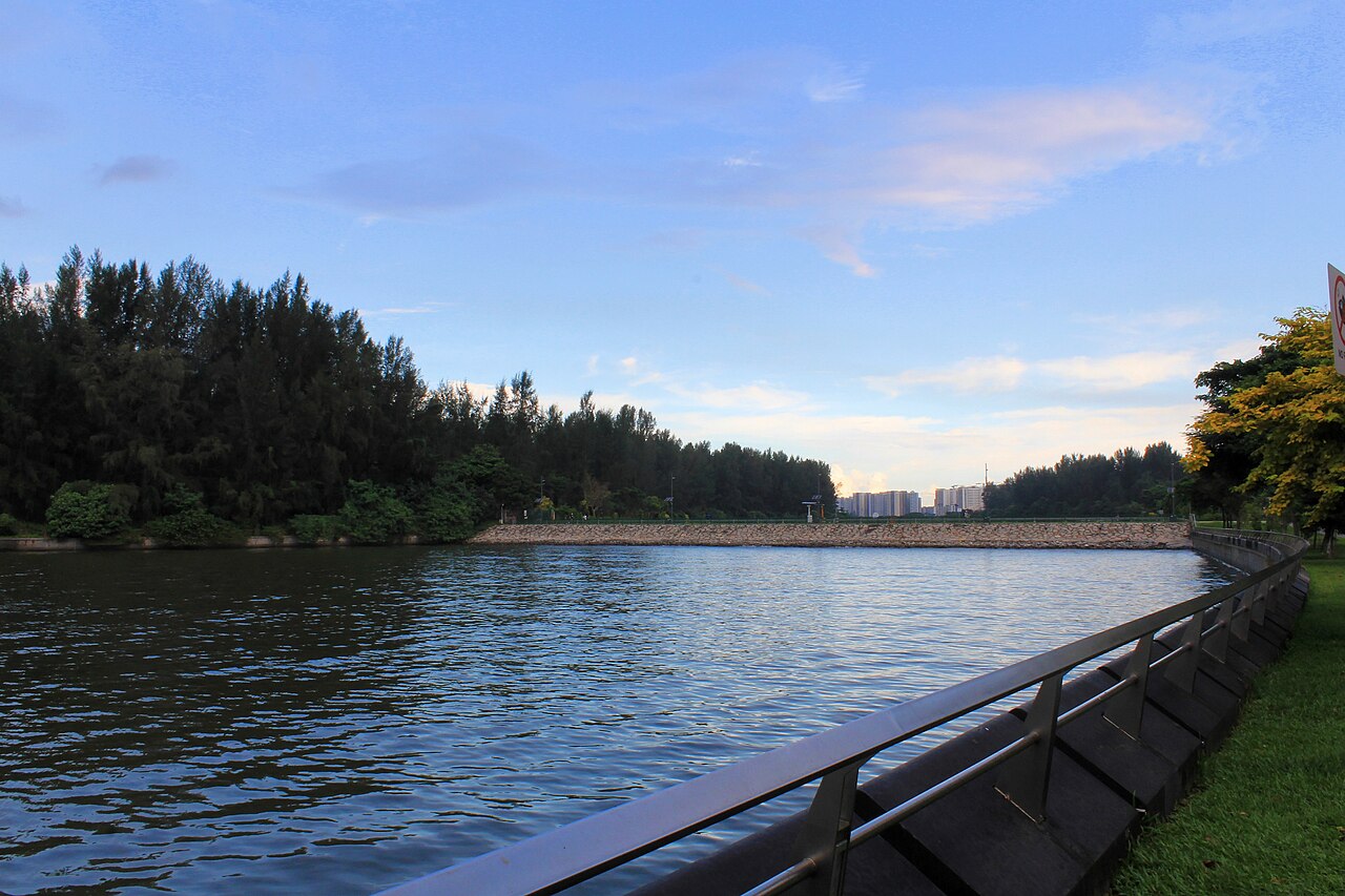
From Punggol Settlement, follow the Punggol Promenade Nature Walk east along the coast for about 30 minutes — or rent a bike to do it in 10. You'll arrive at the west entrance of Coney Island Park (officially Pulau Serangoon), a deliberately-kept-wild 80-hectare island with coastal forest, a 2.5km central path and five sandy beach areas. The east entrance comes out near Lorong Halus Wetland.
This is the contrast that makes the Punggol trip work: half a kilometre to the west you have a brand-new HDB estate with a digital district; half a kilometre to the east you have wild casuarina trees, kingfishers and (in season) the occasional otter colony.
A half-day in Punggol
- 9:00am — Punggol MRT, breakfast at the food court inside Punggol Plaza or Waterway Point.
- 10:00am — rent a bike, ride along the Waterway from Wave Bridge to Kelong Bridge.
- 12:30pm — lunch at Punggol Settlement — chilli crab and a beer with a view of the Johor Strait.
- 2:00pm — walk or ride east via the Punggol Promenade to Coney Island.
- 4:30pm — head back via bus 84 to Punggol MRT.
Practical tips
- Bike rentals at Punggol Settlement run S$8–15 per hour or for the day; bring a card.
- Sunblock and water — most of the route is exposed; the morning is much kinder than the afternoon.
- Seafood restaurants at Punggol Settlement get busy on weekend evenings — reserve ahead.
- Toilets and water refills at Punggol Waterway Park, Punggol Settlement and the Coney Island west entrance — nothing inside the island.
Why GoBus SG helps here
Punggol's bus and LRT timings get sparser in the evenings, particularly the loops back to the MRT. With live arrivals you can finish your Coney Island walk, glance at the home-screen widget, and time your way back to the train without standing at a stop in the rain.
Open these stops in GoBus SG
Search any MRT, LRT or bus stop above for live arrivals across the network — with home-screen widgets and multi-modal trip planning.